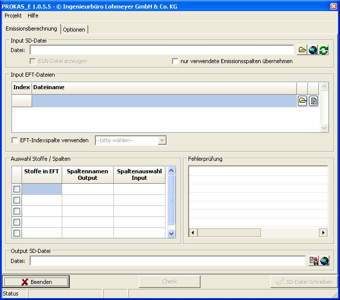
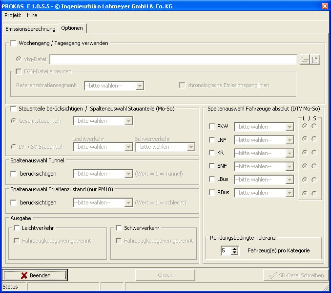
The calculation of emissions on the road sections under consideration requires the following traffic-specific data:
- Traffic situation as a combination of area, road type, speed limit, information on the level of service and longitudinal gradient
- Average daily traffic volume (ADTV)
- Share of heavy duty vehicles
- Optional: absolute vehicle numbers for cars seperated by the vehicle categories two-wheelers, heavy and light duty vehicles as well as buses and coaches in the ADTV
This information must be provided in SD3 format (ASCII or ESRI shape format).
In addition, one or more emission factor tables (EFT3 format) are required for the reference years under consideration.
PROKAS_E includes the following functionalities:
- Loading a SD3 file (ASCII and ESRI shape format)
- Loading and displaying EFT3 file
- Error checking of the input files
- Free selection of the pollutants to be used
- Consideration of additional traffic-jam components
- Consideration of deviating non-engine-related emissions (PM10) in tunnels or in poor road conditions
- Tunnels or poor road conditions
- Output of emissions for each road section as the sum of all vehicle categories or
- Alternatively: Output of emissions by vehicle category separately or by groups summarized according to mileage shares
- Calculation of emissions and writing of the SD3 file (ASCII or Shape format)
- All important information (including the emission factors used in table format) relating to the emissions calculation is saved in formatted form in a project log file in Excel format.
- Note: when using SD3 files in ASCII format, not all PROKAS_E functions are available (e.g. deleting unused columns).


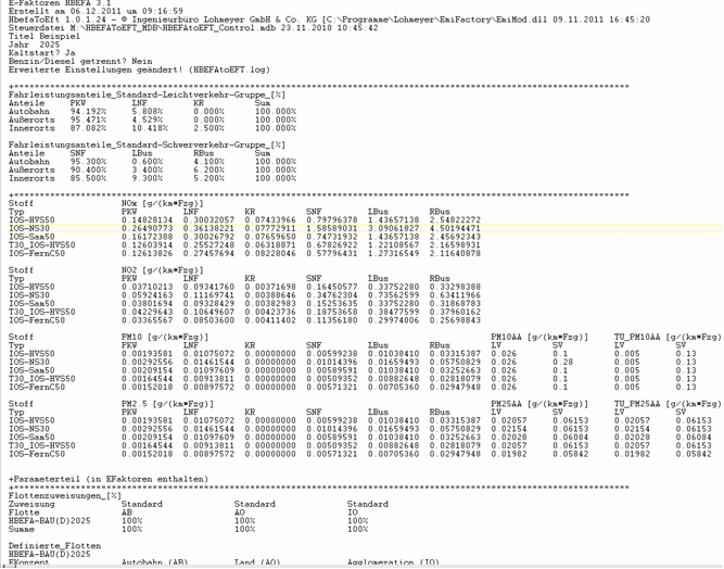
Extract from sample files
Emission factor table (EFT3 file)-excerpt:

SD3 file
The SD3 file in the corresponding format contains the definition of the road segments with the road width, the specific emissions for NOx, benzene, soot, PM10 and the substances 5 to 10 as placeholders for further emitters (ASCII format), the traffic volumes, truck shares, driving patterns and source height of the emissions of the road segments. A line must be created for each road segment. The numerical values arranged in columns must be separated by semicolons in ASCII format. Tabs are not permitted.
